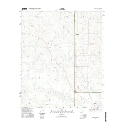
2017 Map of Ravanna
USGS Topo · Published 2017About this map
Three States sits at the unique geographic intersection where Texas, Arkansas, and Louisiana converge, serving as a primary focal point for this 2017 survey. The landscape is defined by the winding course of Black Bayou and State Line Cr, which delineate the political boundaries between Cass County, Miller County, and Caddo Parish. The settlement pattern is characterized by small rural communities like Smyrna and Ravanna linked by a network of county roads and farm-to-market routes. Genealogists and local historians will find significant value in the location of the Beech Creek Cem and Brown Cem, which provide anchors for family research in this tri-state borderland. The terrain is marked by numerous small tributaries including Bull Cr and W Fork Kelly Bayou, reflecting a low-lying, water-rich environment where the state borders were physically shaped by the hydrology of the Red River basin.
Find a feature on this map
83 named features on this map. Tap any name to fly to it.
Don’t see what you’re looking for? This feature index may not catch every label — zoom into the map to look around manually.
Map Details
Editions of this 2017 Ravanna Map
This is the sole edition of this map. No revisions or reprints were ever made.
Other maps of this area

1907 · Atlanta
USGS Topo · 1:62,500

1910 · Atlanta
USGS Topo · 1:62,500

1932 · Hosston NW
USGS Topo · 1:31,680

1944 · Kildare
USGS Topo · 1:62,500

1948 · Kildare
USGS Topo · 1:62,500

1948 · Vivian
USGS Topo · 1:62,500

1952 · Doddridge NW
USGS Topo · 1:24,000

1952 · Doddridge
USGS Topo · 1:24,000

1953 · Texarkana
USGS Topo · 1:250,000

1953 · El Dorado
USGS Topo · 1:250,000