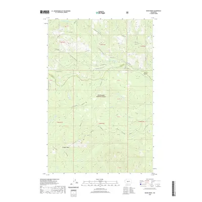
2020 Map of Raven Roost
USGS Topo · Published 2020About this map
Pyramid Peak and Raven Roost anchor this high-elevation landscape within the Snoqualmie National Forest, where the headwaters of the Little Naches River system converge. The terrain is defined by the complex drainage network of the N Fork, Middle Fork, and S Fork Little Naches River, creating a series of deep valleys and sharp ridges. Notable high-country features include Timothy Meadow and Louisiana Saddle, which provide natural landmarks for backcountry navigation. The western edge of the map is traversed by the Pacific Crest National Scenic Trail, a major recreational artery that follows the ridgelines. Historic transit routes like the 4Wd Naches Pass and Greenwater/Naches (Snow) route intersect with more modern infrastructure like the Pipeline crossing near Crow Cr, illustrating the area's continued use for both recreation and resource transport.
Find a feature on this map
43 named features on this map. Tap any name to fly to it.
Don’t see what you’re looking for? This feature index may not catch every label — zoom into the map to look around manually.
Map Details
Editions of this 2020 Raven Roost Map
This is the sole edition of this map. No revisions or reprints were ever made.
Other maps of this area

1901 · Snoqualmie Pass
USGS Topo · 1:125,000

1902 · Mount Aix
USGS Topo · 1:125,000

1903 · Snoqualmie
USGS Topo · 1:125,000

1904 · Mt Aix
USGS Topo · 1:125,000

1950 · Yakima
USGS Topo · 1:250,000

1957 · Wenatchee
USGS Topo · 1:250,000

1958 · Yakima
USGS Topo · 1:250,000

1961 · Yakima
USGS Topo · 1:250,000

1961 · Easton
USGS Topo · 1:62,500

1962 · Bumping Lake
USGS Topo · 1:62,500