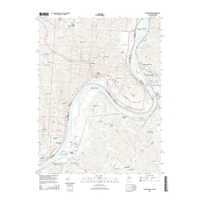
2014 Map of Ravenswood
USGS Topo · Published 2014About this map
Ohio River dominates this landscape, winding past the major bend at Great Bend and sheltering the significant Buffington Island near the northern edge of Jackson County. This river corridor remains the primary artery for the region, where the Ravenswood Ferry and the William S Ritchie Jr Bridge facilitate transit between West Virginia and Ohio. The river's influence is seen in the series of small settlements and landings that dot its banks, including Hills Crossing, Saxon, and Ripley Landing.
Find a feature on this map
171 named features on this map. Tap any name to fly to it.
Don’t see what you’re looking for? This feature index may not catch every label — zoom into the map to look around manually.
Map Details
Editions of this 2014 Ravenswood Map
This is the sole edition of this map. No revisions or reprints were ever made.
Other maps of this area

1906 · Belleville
USGS Topo · 1:62,500

1907 · Keno
USGS Topo · 1:62,500

1907 · Ripley
USGS Topo · 1:62,500

1908 · Ravenswood
USGS Topo · 1:62,500

1924 · Belleville
USGS Topo · 1:62,500

1926 · Ravenswood
USGS Topo · 1:62,500

1926 · Belleville
USGS Topo · 1:62,500

1926 · Ripley
USGS Topo · 1:62,500

1928 · Ravenswood
USGS Topo · 1:62,500

1928 · Ripley
USGS Topo · 1:62,500