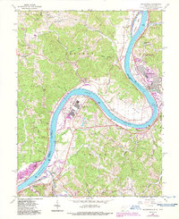
2023 Map of Ravenswood
USGS Topo · Published 2023About this map
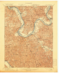
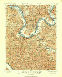
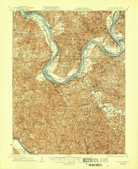
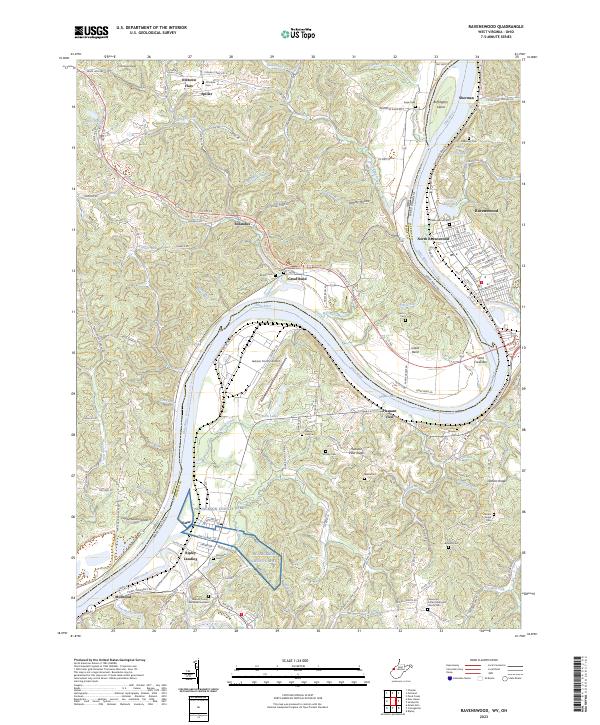
Ravenswood and North Ravenswood occupy the eastern bank of the Ohio River as it forms a wide, westward-leaning bend punctuated by Buffington Island. This river-driven landscape is defined by the sharp contrast between the broad alluvial flats of Oldtown Flats and the deeply dissected ridges of the interior, including McKenzie Ridge and Lathem Ridge. The map documents a blend of industrial and agricultural life, from the Jackson County Airport and Ripley Landing to numerous small family and community burial grounds such as Bethlehem Cem, Byrdie Cem, and Lathem Ridge Cem. The intricate network of drainage, including Groundhog Creek, Mill Creek, and Toms Run, illustrates the rugged topography that has historically channeled transportation and settlement into narrow valleys and along the river's edge. This modern survey provides a detailed view of the infrastructure and legacy sites throughout the Jackson Co and Meigs Co border region.
Find a feature on this map
148 named features on this map. Tap any name to fly to it.
Don’t see what you’re looking for? This feature index may not catch every label — zoom into the map to look around manually.
Map Details
Editions of this 2023 Ravenswood Map
This is the sole edition of this map. No revisions or reprints were ever made.
Historical Maps of Spiller Through Time
6 maps found