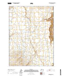
2020 Map of Rawhide Springs
USGS Topo · Published 2020About this map
Rawhide Springs serves as a remote focal point in this corner of Malheur County, where the high desert landscape is defined by an intricate network of drainage systems and intermittent water sources. The terrain is deeply incised by Steer Canyon and Long Canyon, with the W Little Owyhee River skirting the eastern edge of the survey area. In a region where water management is critical for land use, Colossal Reservoir stands out as a significant landmark alongside natural features like Sacramento Hill.
Find a feature on this map
21 named features on this map. Tap any name to fly to it.
Don’t see what you’re looking for? This feature index may not catch every label — zoom into the map to look around manually.
Map Details
Editions of this 2020 Rawhide Springs Map
This is the sole edition of this map. No revisions or reprints were ever made.
Other maps of this area

1955 · Jordan Valley
USGS Topo · 1:250,000

1957 · Jordan Valley
USGS Topo · 1:250,000

1958 · Jordan Valley
USGS Topo · 1:250,000
1982 · Rawhide Pocket
USGS Topo · 1:24,000
1982 · Starvation Spring
USGS Topo · 1:24,000
1982 · Peacock Lake
USGS Topo · 1:24,000

1982 · Guadalupe Meadows
USGS Topo · 1:24,000
1982 · Stoney Corral
USGS Topo · 1:24,000
1982 · Rawhide Springs
USGS Topo · 1:24,000
1982 · No Crossing Crossing
USGS Topo · 1:24,000