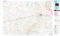
1984 Map of Rawlins
USGS Topo · Published 1984About this map
The Union Pacific railroad and Interstate 80 corridor form the backbone of this mid-1980s landscape, connecting high-desert settlements from Wamsutter to Rawlins. This high-altitude basin is dominated by the Great Divide Basin, where internal drainage creates unique features like the Chain Lakes and Mud Springs Flats. The industrial character of the era is evident through the energy and infrastructure sectors, notably the Cherokee Mine No. 1 and Cherokee Mine No. 2, along with the State Penitentiary located on the eastern edge of Rawlins.
Find a feature on this map
44 named features on this map. Tap any name to fly to it.
Don’t see what you’re looking for? This feature index may not catch every label — zoom into the map to look around manually.
Map Details
Editions of this 1984 Rawlins Map
This is the sole edition of this map. No revisions or reprints were ever made.
Other maps of this area

1893 · Fort Steele
USGS Topo · 1:125,000

1914 · Walcott
USGS Topo · 1:62,500

1932 · Savery
USGS Topo · 1:96,000

1939 · Saratoga
USGS Topo · 1:125,000

1940 · Savery
USGS Topo · 1:125,000

1953 · Wild Horse Mountain
USGS Topo · 1:24,000

1953 · Sinclair
USGS Topo · 1:24,000

1953 · Seminoe Dam SW
USGS Topo · 1:24,000

1953 · Riddle Cut
USGS Topo · 1:24,000

1953 · Rawlins
USGS Topo · 1:24,000