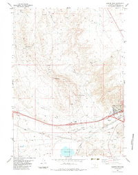
1983 Map of Rawlins Peak
USGS Topo · Published 1983About this map
The high desert landscape of Carbon County is defined here by the industrial and natural intersection at Rawlins. The city sits at the foot of Rawlins Peak and Cherokee Peak, serving as a critical node for the Union Pacific railroad. The presence of an Old Railroad Grade and numerous pipelines running alongside the tracks illustrates the long-standing role of this corridor as a primary energy and transportation artery across the Wyoming basin.
Find a feature on this map
39 named features on this map. Tap any name to fly to it.
Don’t see what you’re looking for? This feature index may not catch every label — zoom into the map to look around manually.
Map Details
Editions of this 1983 Rawlins Peak Map
This is the sole edition of this map. No revisions or reprints were ever made.
Other maps of this area

1953 · Rawlins
USGS Topo · 1:24,000

1953 · Rawlins NW
USGS Topo · 1:24,000

1954 · Rawlins
USGS Topo · 1:250,000

1956 · Rawlins Peak
USGS Topo · 1:62,500

1956 · Bridger Pass
USGS Topo · 1:62,500

1956 · Bolten Ranch
USGS Topo · 1:62,500

1958 · Rawlins
USGS Topo · 1:250,000

1962 · Rawlins
USGS Topo · 1:250,000

1967 · Rawlins
USGS Topo · 1:250,000
1983 · Coal Mine Ridge
USGS Topo · 1:24,000