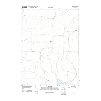
2010 Map of Rawson
USGS Topo · Published 2010About this map
Caneadea Creek and Rush Creek carve through this rural Allegany County landscape, shaping a network of crossroads settlements and family farms. At the northern edge, Hardy Corners and the nearby Hardys Corners Cemetery anchor a historic community, while the central hamlet of Rawson serves as a junction for local travel. The terrain is marked by numerous family-named routes, including Taylor Hill Rd and Baldwin Hill Rd, which suggest the agricultural lineage of the region. To the south, the waters of Cuba Lake provide a distinct geographic boundary near Abbotts. The map reveals a persistent pattern of small-scale settlement at places like Lyndon and Rawson Valley, where development follows the stream valleys and local road intersections established generations earlier.
Find a feature on this map
50 named features on this map. Tap any name to fly to it.
Don’t see what you’re looking for? This feature index may not catch every label — zoom into the map to look around manually.
Map Details
Editions of this 2010 Rawson Map
This is the sole edition of this map. No revisions or reprints were ever made.
Other maps of this area

1898 · Olean
USGS Topo · 1:62,500

1906 · Angelica
USGS Topo · 1:62,500

1924 · Franklinville
USGS Topo · 1:62,500

1925 · Belmont
USGS Topo · 1:62,500

1938 · Olean
USGS Topo · 1:62,500

1939 · Belmont
USGS Topo · 1:62,500

1941 · Angelica
USGS Topo · 1:62,500

1942 · Franklinville
USGS Topo · 1:62,500

1943 · Olean
USGS Topo · 1:62,500

1960 · Buffalo
USGS Topo · 1:250,000