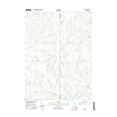
2016 Map of Rawson
USGS Topo · Published 2016About this map
Hardy Corners and Rawson anchor this rural landscape straddling the line between Cattaraugus and Allegany Counties. The terrain is defined by the high divides between creek valleys, notably where Caneadea Creek and Rawson Creek carve through the uplands. This area shows a persistent pattern of crossroads hamlets like Abbotts and Lyons Corners, often marked by their respective burial grounds such as Hardys Corners Cemetery and Abbotts Cemetery. Near the southern edge, the map captures the transition from the hills to the waters of Cuba Lake. An interesting historical trace appears in the southeast corner with the Genesee Valley Canal, providing a clear reference point for industrial history and early transport routes. Long-distance recreation is represented by the North Country National Scenic Trail as it winds through the northern woods.
Find a feature on this map
72 named features on this map. Tap any name to fly to it.
Don’t see what you’re looking for? This feature index may not catch every label — zoom into the map to look around manually.
Map Details
Editions of this 2016 Rawson Map
This is the sole edition of this map. No revisions or reprints were ever made.
Other maps of this area

1898 · Olean
USGS Topo · 1:62,500

1906 · Angelica
USGS Topo · 1:62,500

1924 · Franklinville
USGS Topo · 1:62,500

1925 · Belmont
USGS Topo · 1:62,500

1938 · Olean
USGS Topo · 1:62,500

1939 · Belmont
USGS Topo · 1:62,500

1941 · Angelica
USGS Topo · 1:62,500

1942 · Franklinville
USGS Topo · 1:62,500

1943 · Olean
USGS Topo · 1:62,500

1960 · Buffalo
USGS Topo · 1:250,000