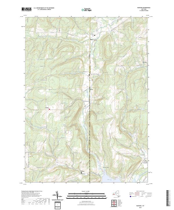
2023 Map of Rawson
USGS Topo · Published 2023About this map
The boundary between Cattaraugus and Allegany counties bisects this landscape, where the rural hamlets of Rawson and Lyndon are connected by a network of local roads including Lyndon Center Rd. The topography is defined by the Rawson Valley, with drainage provided by Rawson Creek and the meandering Caneadea Creek to the north. In the southeastern corner, the map shows the upper reach of Cuba Lake and the remains of the Genesee Valley Canal, a significant 19th-century engineering feat that once linked the Genesee River to the Allegheny River. For genealogists, the map identifies several local burial grounds, including Hardys Corners Cem, Rawson Cem, and Abbotts Cem near the settlement of Abbotts. This modern survey records the enduring footprint of these small farming communities and their historic transportation corridors.
Find a feature on this map
70 named features on this map. Tap any name to fly to it.
Don’t see what you’re looking for? This feature index may not catch every label — zoom into the map to look around manually.
Map Details
Editions of this 2023 Rawson Map
This is the sole edition of this map. No revisions or reprints were ever made.
Other maps of this area

1898 · Olean
USGS Topo · 1:62,500

1906 · Angelica
USGS Topo · 1:62,500

1924 · Franklinville
USGS Topo · 1:62,500

1925 · Belmont
USGS Topo · 1:62,500

1938 · Olean
USGS Topo · 1:62,500

1939 · Belmont
USGS Topo · 1:62,500

1941 · Angelica
USGS Topo · 1:62,500

1942 · Franklinville
USGS Topo · 1:62,500

1943 · Olean
USGS Topo · 1:62,500

1960 · Buffalo
USGS Topo · 1:250,000