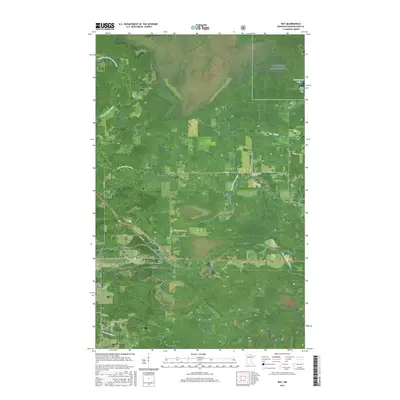
2016 Map of Ray
USGS Topo · Published 2016About this map
Voyageurs National Park covers the northern reaches of this landscape, where the waters of Kabetogama Lake reach into Tom Cod Bay. This 2016 survey highlights a region defined by its complex hydrology, dominated by the meandering Rat Root River and its tributary, the East Branch Rat Root River. The small settlement of Ray serves as the local hub, situated at the intersection of several county and township routes that navigate the surrounding wetlands. For those researching local history, the map precisely locates the Ray Cem and Lyman Cem, providing essential coordinate data for genealogical study. The network of township roads, such as Town Rd 187 and Town Rd 247, reveals the sparse but structured pattern of habitation in this part of Koochiching County.
Find a feature on this map
28 named features on this map. Tap any name to fly to it.
Don’t see what you’re looking for? This feature index may not catch every label — zoom into the map to look around manually.
Map Details
Editions of this 2016 Ray Map
This is the sole edition of this map. No revisions or reprints were ever made.
Other maps of this area

1919 · International Falls
USGS Topo · 1:62,500

1954 · International Falls
USGS Topo · 1:250,000

1957 · International Falls
USGS Topo · 1:250,000

1958 · International Falls
USGS Topo · 1:250,000

1963 · Ranier
USGS Topo · 1:24,000

1969 · Ray SE
USGS Topo · 1:24,000

1969 · Island View
USGS Topo · 1:24,000

1969 · Ericsburg
USGS Topo · 1:24,000

1969 · Ericsburg SE
USGS Topo · 1:24,000

1969 · Ray
USGS Topo · 1:24,000