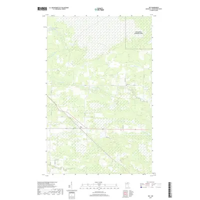
2019 Map of Ray
USGS Topo · Published 2019About this map
Ray occupies a central position in this Koochiching County landscape, serving as a crossroads between rural routes like Co RD 110 and Co HWY 29. The geography is defined by the winding course of the East Branch Rat Root River and its tributary, Tom Cod Cr, which meander through a region dominated by wetlands and conservation interests. In the northeastern corner, the boundary of Voyageurs National Park signifies the transition into protected wilderness, while the presence of the Farm Service Agency Interest of Minnesota lands indicates complex patterns of land management and agricultural oversight. For those researching local lineages, the Ray Cem and Lyman Cem provide essential geographic markers for early residents of this northern Minnesota timber and wetland country.
Find a feature on this map
29 named features on this map. Tap any name to fly to it.
Don’t see what you’re looking for? This feature index may not catch every label — zoom into the map to look around manually.
Map Details
Editions of this 2019 Ray Map
This is the sole edition of this map. No revisions or reprints were ever made.
Other maps of this area

1919 · International Falls
USGS Topo · 1:62,500

1954 · International Falls
USGS Topo · 1:250,000

1957 · International Falls
USGS Topo · 1:250,000

1958 · International Falls
USGS Topo · 1:250,000

1963 · Ranier
USGS Topo · 1:24,000

1969 · Ray SE
USGS Topo · 1:24,000

1969 · Island View
USGS Topo · 1:24,000

1969 · Ericsburg
USGS Topo · 1:24,000

1969 · Ericsburg SE
USGS Topo · 1:24,000

1969 · Ray
USGS Topo · 1:24,000