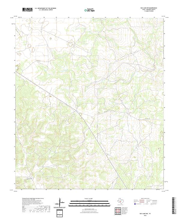
2022 Map of Ray Lake NW
USGS Topo · Published 2022About this map
The S Llano River carves through this portion of Edwards County, defining a landscape of high plateaus and deep drainage channels. This modern survey illustrates the sparse, ranch-oriented infrastructure of the Texas Hill Country, where narrow corridors like Harrison Rd and Ranch Rd 2995 provide the only access across the varying elevations. The topographic data reveals a complex system of seasonal watercourses, including Wheat Draw in the northwest and Buffalo Draw in the southwest, which drain toward the river basin. While the map is dominated by open terrain, the network of local routes such as Co Rd 101 and Sd 74100 indicates the enduring boundaries of large landholdings and rural estates that characterize this region of the Edwards Plateau.
Find a feature on this map
7 named features on this map. Tap any name to fly to it.
Don’t see what you’re looking for? This feature index may not catch every label — zoom into the map to look around manually.
Map Details
Editions of this 2022 Ray Lake NW Map
This is the sole edition of this map. No revisions or reprints were ever made.
Other maps of this area

1893 · Rock Springs
USGS Topo · 1:125,000

1954 · Sonora
USGS Topo · 1:250,000

1958 · Sonora
USGS Topo · 1:250,000

1962 · Stewart Ranch
USGS Topo · 1:24,000

1963 · Harrison Ranch
USGS Topo · 1:24,000

1967 · Dunbar Draw SE
USGS Topo · 1:24,000

1970 · Ray Lake NW
USGS Topo · 1:24,000
1971 · Ray Lake SE
USGS Topo · 1:24,000
1971 · Ray Lake
USGS Topo · 1:24,000

1971 · Turney Draw SE
USGS Topo · 1:24,000