
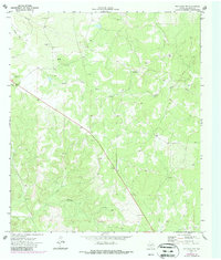
1970 Map of Ray Lake NW
USGS Topo · Published 1973About this map
The South Llano River carves a winding path through this portion of Edwards County, defining a landscape marked by significant elevation changes and deep drainage patterns. Established survey markers such as Lantern BM 2331 and BM 2310 provide a framework for the undulating terrain, which is further shaped by Wheat Draw in the northwest and the expansive Buffalo Draw to the south.
Find a feature on this map
16 named features on this map. Tap any name to fly to it.
Don’t see what you’re looking for? This feature index may not catch every label — zoom into the map to look around manually.
Map Details
Editions of this 1970 Ray Lake NW Map
2 editions found
Other maps of this area

1893 · Rock Springs
USGS Topo · 1:125,000

1954 · Sonora
USGS Topo · 1:250,000

1958 · Sonora
USGS Topo · 1:250,000

1962 · Stewart Ranch
USGS Topo · 1:24,000

1963 · Harrison Ranch
USGS Topo · 1:24,000

1967 · Dunbar Draw SE
USGS Topo · 1:24,000
1971 · Ray Lake SE
USGS Topo · 1:24,000
1971 · Ray Lake
USGS Topo · 1:24,000

1971 · Turney Draw SE
USGS Topo · 1:24,000
1971 · Turney Draw NE
USGS Topo · 1:24,000