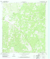
1970 Map of Ray Lake NW
USGS Topo · Published 1987About this map
South Llano River carves a winding path through this corner of Edwards County, defining the drainage patterns of a landscape marked by deep draws and limestone features. This 1970 survey, later updated in the 1980s, documents a transition in land use where traditional ranching infrastructure meets early industrial activity. Resource extraction is evident through the numerous Gravel Pit and Gravel Pits sites scattered across the terrain, while the subsurface is explored via a Drill Hole and several Well locations. The drainage network is anchored by Wheat Draw in the north and Buffalo Draw to the south, highlighting the seasonal watercourses that shape this part of the Texas Hill Country. A notable natural feature, a Cave, appears in the southwest, offering a specific point of interest for geological study or local exploration.
Find a feature on this map
9 named features on this map. Tap any name to fly to it.
Don’t see what you’re looking for? This feature index may not catch every label — zoom into the map to look around manually.
Map Details
Editions of this 1970 Ray Lake NW Map
2 editions found
Other maps of this area

1893 · Rock Springs
USGS Topo · 1:125,000

1954 · Sonora
USGS Topo · 1:250,000

1958 · Sonora
USGS Topo · 1:250,000

1962 · Stewart Ranch
USGS Topo · 1:24,000

1963 · Harrison Ranch
USGS Topo · 1:24,000

1967 · Dunbar Draw SE
USGS Topo · 1:24,000

1970 · Ray Lake NW
USGS Topo · 1:24,000
1971 · Ray Lake SE
USGS Topo · 1:24,000
1971 · Ray Lake
USGS Topo · 1:24,000

1971 · Turney Draw SE
USGS Topo · 1:24,000