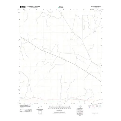
2010 Map of Ray Lake SE
USGS Topo · Published 2010About this map
Edwards County's sprawling ranch lands are captured here during a period of modern mapping that emphasizes the area's vast drainage networks and essential transportation corridors. The landscape is defined by the winding paths of ephemeral stream beds that carve through the limestone terrain, illustrating the hydrologic character of the Edwards Plateau. Connectivity across these rangelands is maintained by long-established thoroughfares such as Old Sonora Rd and Ranch Rd 2995. These routes follow the natural contours of the land, providing a record of the rural infrastructure that has supported the region's agricultural and ranching heritage for generations. The lack of concentrated settlements highlights the remote, open-range nature of this portion of Southwest Texas.
Find a feature on this map
2 named features on this map. Tap any name to fly to it.
Don’t see what you’re looking for? This feature index may not catch every label — zoom into the map to look around manually.
Map Details
Editions of this 2010 Ray Lake SE Map
This is the sole edition of this map. No revisions or reprints were ever made.
Other maps of this area

1893 · Rock Springs
USGS Topo · 1:125,000

1893 · Nueces
USGS Topo · 1:125,000

1896 · Nueces
USGS Topo · 1:125,000

1944 · Indian Creek
USGS Topo · 1:62,500

1947 · Hackberry
USGS Topo · 1:62,500

1954 · Sonora
USGS Topo · 1:250,000

1958 · Sonora
USGS Topo · 1:250,000

1958 · Del Rio
USGS Topo · 1:250,000

1964 · Del Rio
USGS Topo · 1:250,000

1970 · Ray Lake NW
USGS Topo · 1:24,000