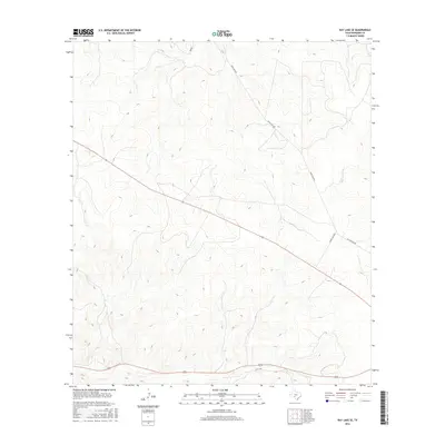
2016 Map of Ray Lake SE
USGS Topo · Published 2016About this map
Ranch Rd 2995 cuts diagonally across this high plateau landscape in Edwards County, illustrating the modern transportation network that services the expansive ranching properties of the Texas Hill Country. The terrain is defined by a dense network of draws and ridges, where the elevation fluctuates sharply between 2,100 and 2,350 feet. Unlike the primary state-maintained routes, historical paths like Old Sonora Rd and local connectors such as Co Rd 430 follow the natural contours of the land, tracing the edges of deep drainages. This 2016 survey captures a transitional moment where traditional ranching access routes intersect with modernized infrastructure, providing a precise topographic view of the limestone-carved geography that characterizes this part of Southwest Texas.
Find a feature on this map
3 named features on this map. Tap any name to fly to it.
Don’t see what you’re looking for? This feature index may not catch every label — zoom into the map to look around manually.
Map Details
Editions of this 2016 Ray Lake SE Map
This is the sole edition of this map. No revisions or reprints were ever made.
Other maps of this area

1893 · Rock Springs
USGS Topo · 1:125,000

1893 · Nueces
USGS Topo · 1:125,000

1896 · Nueces
USGS Topo · 1:125,000

1944 · Indian Creek
USGS Topo · 1:62,500

1947 · Hackberry
USGS Topo · 1:62,500

1954 · Sonora
USGS Topo · 1:250,000

1958 · Sonora
USGS Topo · 1:250,000

1958 · Del Rio
USGS Topo · 1:250,000

1964 · Del Rio
USGS Topo · 1:250,000

1970 · Ray Lake NW
USGS Topo · 1:24,000