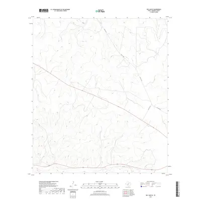
2019 Map of Ray Lake SE
USGS Topo · Published 2019About this map
Deep drainage cuts and high-elevation ridges dominate this portion of the Texas Hill Country in Edwards County. The landscape is defined by the winding path of Ranch Rd 2995, which follows the high ground between complex canyon systems. Historically significant travel routes such as the Old Sonora Rd cut across the eastern terrain, reflecting the long-standing transport patterns required to navigate this limestone plateau. In the southern reaches, Co Rd 430 skirts the base of the ridges, following the natural contours of the land. This 2019 survey by the U.S. Geological Survey illustrates a region where modern infrastructure continues to rely on traditional geographic corridors.
Find a feature on this map
3 named features on this map. Tap any name to fly to it.
Don’t see what you’re looking for? This feature index may not catch every label — zoom into the map to look around manually.
Map Details
Editions of this 2019 Ray Lake SE Map
This is the sole edition of this map. No revisions or reprints were ever made.
Other maps of this area

1893 · Rock Springs
USGS Topo · 1:125,000

1893 · Nueces
USGS Topo · 1:125,000

1896 · Nueces
USGS Topo · 1:125,000

1944 · Indian Creek
USGS Topo · 1:62,500

1947 · Hackberry
USGS Topo · 1:62,500

1954 · Sonora
USGS Topo · 1:250,000

1958 · Sonora
USGS Topo · 1:250,000

1958 · Del Rio
USGS Topo · 1:250,000

1964 · Del Rio
USGS Topo · 1:250,000

1970 · Ray Lake NW
USGS Topo · 1:24,000