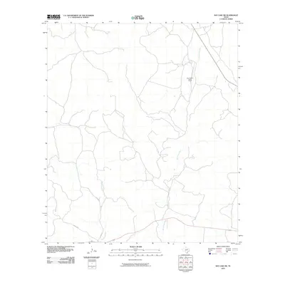
2010 Map of Ray Lake SW
USGS Topo · Published 2010About this map
The West Nueces River carves a winding path through this corner of Edwards County, defining the drainage patterns of a landscape marked by intermittent watercourses and ranching infrastructure. Private aviation access is highlighted by the Four Square Ranch Airport, situated on the plateau above the river valley. The map documents the rural road network as it stood a decade into the 21st century, including the junction of Co RD 104 W and Co RD 104 E, which provide local access through the hilly terrain near Geronimo Creek. Highway 377 cuts across the southern portion of the sheet, serving as the primary transit artery for this remote portion of the Texas Hill Country.
Find a feature on this map
7 named features on this map. Tap any name to fly to it.
Don’t see what you’re looking for? This feature index may not catch every label — zoom into the map to look around manually.
Map Details
Editions of this 2010 Ray Lake SW Map
This is the sole edition of this map. No revisions or reprints were ever made.
Other maps of this area

1893 · Rock Springs
USGS Topo · 1:125,000

1893 · Nueces
USGS Topo · 1:125,000

1896 · Nueces
USGS Topo · 1:125,000

1943 · Carta Valley
USGS Topo · 1:62,500

1944 · Indian Creek
USGS Topo · 1:62,500

1954 · Sonora
USGS Topo · 1:250,000

1958 · Sonora
USGS Topo · 1:250,000

1958 · Del Rio
USGS Topo · 1:250,000

1964 · Del Rio
USGS Topo · 1:250,000

1970 · Ray Lake NW
USGS Topo · 1:24,000