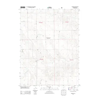
2013 Map of Raymer NE
USGS Topo · Published 2013About this map
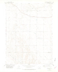
Pawnee National Grassland dominates this high plains landscape of northeastern Colorado, where the drainage patterns of North Pawnee Creek and South Pawnee Creek carve through the section lines of the public land survey system. The map provides a detailed look at the rural infrastructure of the early 2010s, defined by a rigid grid of county roads such as CO Road 127 and CO Road 104 that service the region's ranching and utility operations. Local history is anchored by the Raymer Cem in the southwestern corner, while the presence of the Skyline Windmill and Kibben Windmill points to the continued importance of groundwater management in this arid environment. The inclusion of the Weld County Landfill illustrates the modern industrial footprint amidst the vast grazing lands and seasonal waterways like Wild Horse Creek.
Find a feature on this map
28 named features on this map. Tap any name to fly to it.
Don’t see what you’re looking for? This feature index may not catch every label — zoom into the map to look around manually.
Map Details
Editions of this 2013 Raymer NE Map
This is the sole edition of this map. No revisions or reprints were ever made.
Other maps of this area

1954 · Sterling
USGS Topo · 1:250,000

1958 · Sterling
USGS Topo · 1:250,000
1977 · Pawnee Buttes
USGS Topo · 1:24,000
1977 · Raymer NW
USGS Topo · 1:24,000
1977 · Gatehook Spring
USGS Topo · 1:24,000

1977 · Stoneham
USGS Topo · 1:24,000

1977 · Raymer NE
USGS Topo · 1:24,000
1978 · Buckingham
USGS Topo · 1:24,000

1978 · Stoneham NW
USGS Topo · 1:24,000
1978 · Avalo
USGS Topo · 1:24,000