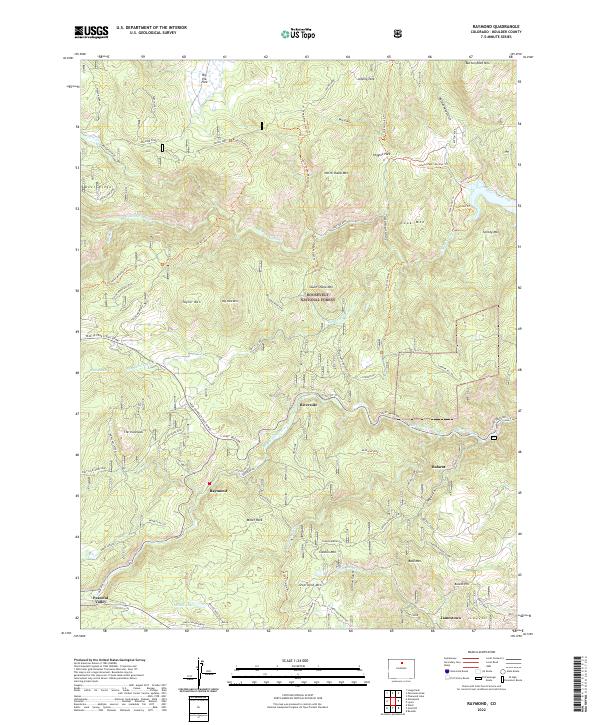
2022 Map of Raymond
USGS Topo · Published 2022About this map
Raymond and the surrounding mountain settlements of Riverside and Balarat are situated within a complex network of high-altitude drainages and forest lands. The landscape is dominated by the Roosevelt National Forest, where the terrain transitions from the deep valley of Middle Saint Vrain Cr up to prominent summits like North Sheep Mtn and Cook Mtn. Modern infrastructure is visible through the Peak To Peak Scenic Byway, which provides access to the higher elevations and recreational landmarks such as The Ironclads.
Find a feature on this map
89 named features on this map. Tap any name to fly to it.
Don’t see what you’re looking for? This feature index may not catch every label — zoom into the map to look around manually.
Map Details
Editions of this 2022 Raymond Map
This is the sole edition of this map. No revisions or reprints were ever made.
Other maps of this area

1902 · Boulder
USGS Topo · 1:62,500

1904 · Boulder
USGS Topo · 1:62,500

1905 · Mount Olympus
USGS Topo · 1:62,500

1907 · Mount Olympus
USGS Topo · 1:62,500

1915 · Longs Peak
USGS Topo · 1:125,000

1919 · Rocky Mountain National Park
USGS Topo · 1:125,000

1954 · Greeley
USGS Topo · 1:250,000

1957 · Greeley
USGS Topo · 1:250,000
1957 · Boulder
USGS Topo · 1:24,000

1957 · Allens Park
USGS Topo · 1:24,000