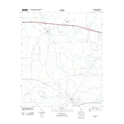
2012 Map of Raymond
USGS Topo · Published 2012About this map
Bolton and Raymond anchor this portion of Hinds County, where the landscape is defined by the dense drainage network of Bakers Cr and its tributaries, including Little Bakers Cr and Fleetwood Cr. The settlement pattern follows a clear transition from the older rural road networks, such as Champion Hill Rd and Old Highway 80, to the modern footprint of the John Bell Williams Airport. Evidence of early community life remains at the Bolton Cem and smaller locales like West View, Norrell, and Lindsey. In the southern reach, the terrain softens around Brytana Lakes and Turkey Spring, while the winding course of Snake Cr cuts through the southeastern quadrant. This survey captures a moment of modern aviation and highway development superimposed over a traditional Mississippi agricultural and creek-bottom landscape.
Find a feature on this map
87 named features on this map. Tap any name to fly to it.
Don’t see what you’re looking for? This feature index may not catch every label — zoom into the map to look around manually.
Map Details
Editions of this 2012 Raymond Map
This is the sole edition of this map. No revisions or reprints were ever made.
Other maps of this area

1903 · Jackson
USGS Topo · 1:125,000

1934 · Raymond
USGS Topo · 1:48,000

1937 · Raymond
USGS Topo · 1:62,500

1937 · Terry
USGS Topo · 1:48,000

1938 · Edwards
USGS Topo · 1:62,500

1942 · Raymond
USGS Topo · 1:62,500

1943 · Terry
USGS Topo · 1:62,500

1955 · Jackson
USGS Topo · 1:250,000

1961 · Jackson
USGS Topo · 1:250,000

1962 · Jackson
USGS Topo · 1:250,000