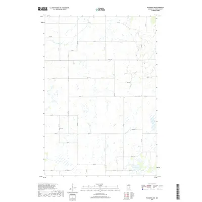
2019 Map of Raymond Lake
USGS Topo · Published 2019About this map
Saint Johns Cem and Lyman Prairie Cem serve as quiet landmarks within this rural section of Stearns County, where the landscape is defined by its agricultural grid and natural drainage systems. The survey area is divided by a network of well-maintained thoroughfares such as Co St Aid Hwy 26 and Co Hwy 28, which connect isolated farmsteads across the township lines. Water features are central to the geography here, notably the namesake Raymond Lake in the southeast corner and the winding courses of Ashley Cr and Hoboken Cr. The placement of these creeks and small wetlands influenced the irregular road patterns seen in areas like the northern reach of Co Rd 183. This 2019 data captures a traditional Minnesota prairie landscape where historic cemetery sites remain the primary cultural anchors amidst modern county roads.
Find a feature on this map
29 named features on this map. Tap any name to fly to it.
Don’t see what you’re looking for? This feature index may not catch every label — zoom into the map to look around manually.
Map Details
Editions of this 2019 Raymond Lake Map
This is the sole edition of this map. No revisions or reprints were ever made.
Other maps of this area

1953 · Saint Cloud
USGS Topo · 1:250,000

1957 · Saint Cloud
USGS Topo · 1:250,000

1958 · Saint Cloud
USGS Topo · 1:250,000

1965 · Westport
USGS Topo · 1:24,000

1965 · Sauk Centre
USGS Topo · 1:24,000

1965 · Padua
USGS Topo · 1:24,000

1965 · Sedan
USGS Topo · 1:24,000

1965 · Raymond Lake
USGS Topo · 1:24,000

1965 · Elrosa
USGS Topo · 1:24,000

1966 · West Union
USGS Topo · 1:24,000