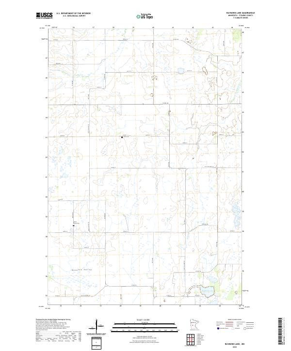
2022 Map of Raymond Lake
USGS Topo · Published 2022About this map
Bonanza Valley defines the landscape of this Stearns County region, where the prairie transitions into a network of small creeks and wetlands. The drainage of Ashley Cr and Hoboken Cr shapes the northern and eastern portions of the map, eventually leading toward Raymond Lake in the southeast. For genealogists and local historians, the sheet preserves the locations of rural landmarks such as Lyman Prairie Cem and Saint Johns Cem, situated along the grid of township roads. The settlement pattern remains largely agricultural, dominated by the Public Land Survey System sections of T125N and T126N, reflecting the enduring rural character of central Minnesota. A dense network of county and township roads, including Co Hwy 28 and Co St Aid Hwy 26, provides clear evidence of the modern transportation infrastructure serving these farmsteads.
Find a feature on this map
39 named features on this map. Tap any name to fly to it.
Don’t see what you’re looking for? This feature index may not catch every label — zoom into the map to look around manually.
Map Details
Editions of this 2022 Raymond Lake Map
This is the sole edition of this map. No revisions or reprints were ever made.
Other maps of this area

1953 · Saint Cloud
USGS Topo · 1:250,000

1957 · Saint Cloud
USGS Topo · 1:250,000

1958 · Saint Cloud
USGS Topo · 1:250,000

1965 · Westport
USGS Topo · 1:24,000

1965 · Sauk Centre
USGS Topo · 1:24,000

1965 · Padua
USGS Topo · 1:24,000

1965 · Sedan
USGS Topo · 1:24,000

1965 · Raymond Lake
USGS Topo · 1:24,000

1965 · Elrosa
USGS Topo · 1:24,000

1966 · West Union
USGS Topo · 1:24,000