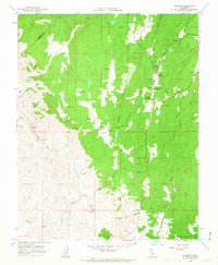
1962 Map of Raymond
USGS Topo · Published 1963About this map
Raymond serves as the focal point of this Central California landscape, situated at the junction of the Sierra foothills and the San Joaquin Valley. The area’s industrial character is defined by granite quarrying and mining, visible through the presence of Knowles and the Raymond Granite Union H S. South of the main settlement, a network of mining operations including the Rosati Shaft, North Shaft, and the Jesse Belle Shaft indicates a history of subsurface exploration near the settlement of Daulton.
Find a feature on this map
29 named features on this map. Tap any name to fly to it.
Don’t see what you’re looking for? This feature index may not catch every label — zoom into the map to look around manually.
Map Details
Editions of this 1962 Raymond Map
3 editions found
Other maps of this area

1912 · Mariposa
USGS Topo · 1:125,000

1919 · Indian Gulch
USGS Topo · 1:48,000

1919 · Raynor Creek
USGS Topo · 1:31,680

1919 · Little Table Mountain
USGS Topo · 1:31,680

1920 · Indian Gulch
USGS Topo · 1:62,500

1920 · Kismet
USGS Topo · 1:31,680

1921 · Daulton
USGS Topo · 1:31,680

1942 · Raymond
USGS Topo · 1:62,500

1942 · Daulton
USGS Topo · 1:24,000

1942 · Little Table Mountain
USGS Topo · 1:24,000