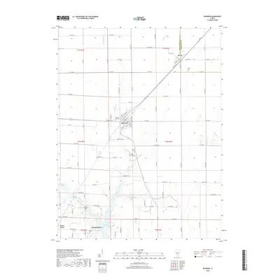
2018 Map of Raymond
USGS Topo · Published 2018About this map
Raymond and Harvel serve as the primary hubs in this agricultural landscape of Montgomery County, where the grid of rural roads is interrupted by the diagonal path of the railway. The map meticulously records numerous burial grounds essential for genealogical research, including Saint Raymonds Cem, Raymond City Cem, and the more isolated Cass Cem. To the south, the terrain transitions toward the waters of Lake Lou Yaeger and the northern reaches of Litchfield. Waterways like West Fork Shoal Creek and Blue Grass Cr wind through the township sections, crossed by local landmarks such as Five Mile Bridge. The settlement of Honey Bend appears in the southwest corner, while the Christian County line forms the northeastern boundary near Harvel, illustrating the intersection of county governance and local transport networks in the early 21st century.
Find a feature on this map
67 named features on this map. Tap any name to fly to it.
Don’t see what you’re looking for? This feature index may not catch every label — zoom into the map to look around manually.
Map Details
Editions of this 2018 Raymond Map
This is the sole edition of this map. No revisions or reprints were ever made.
Other maps of this area

1915 · Mount Olive
USGS Topo · 1:62,500

1923 · Raymond
USGS Topo · 1:62,500

1925 · Raymond
USGS Topo · 1:62,500

1944 · Mount Olive
USGS Topo · 1:62,500

1946 · Nokomis
USGS Topo · 1:62,500

1947 · Hillsboro
USGS Topo · 1:62,500

1949 · Hillsboro
USGS Topo · 1:62,500

1949 · Nokomis
USGS Topo · 1:62,500

1958 · Decatur
USGS Topo · 1:250,000

1961 · Decatur
USGS Topo · 1:250,000