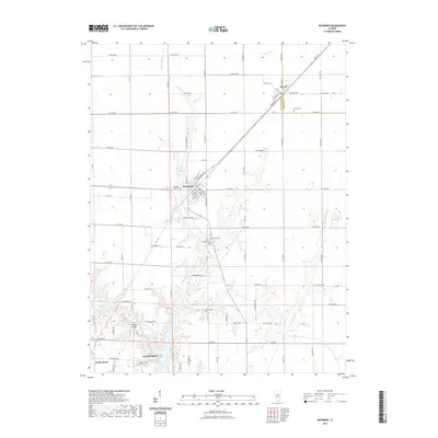
2021 Map of Raymond
USGS Topo · Published 2021About this map
Raymond and Harvel serve as the primary hubs in this Montgomery County landscape, where the agricultural grid is deeply etched into the Illinois prairie. The topography is defined by the winding course of West Fork Shoal Creek and its smaller tributaries like Blue Grass Cr, which break the geometric regularity of the surrounding section lines. These waterways created natural focal points for early infrastructure, evidenced by the Five Mile Bridge and the cluster of rural burial sites that dot the area. Genealogists will find a high concentration of cemeteries, including Raymond City Cem, Saint Raymond Cem, and the more isolated Asbury Cem and Cass Cem. In the southern portion of the map, the northern outskirts of Litchfield and the small settlement of Honey Bend mark the transition toward more industrialized corridors, providing a detailed record of local settlement patterns and land use in the early twenty-first century.
Find a feature on this map
82 named features on this map. Tap any name to fly to it.
Don’t see what you’re looking for? This feature index may not catch every label — zoom into the map to look around manually.
Map Details
Editions of this 2021 Raymond Map
This is the sole edition of this map. No revisions or reprints were ever made.
Other maps of this area

1915 · Mount Olive
USGS Topo · 1:62,500

1923 · Raymond
USGS Topo · 1:62,500

1925 · Raymond
USGS Topo · 1:62,500

1944 · Mount Olive
USGS Topo · 1:62,500

1946 · Nokomis
USGS Topo · 1:62,500

1947 · Hillsboro
USGS Topo · 1:62,500

1949 · Hillsboro
USGS Topo · 1:62,500

1949 · Nokomis
USGS Topo · 1:62,500

1958 · Decatur
USGS Topo · 1:250,000

1961 · Decatur
USGS Topo · 1:250,000