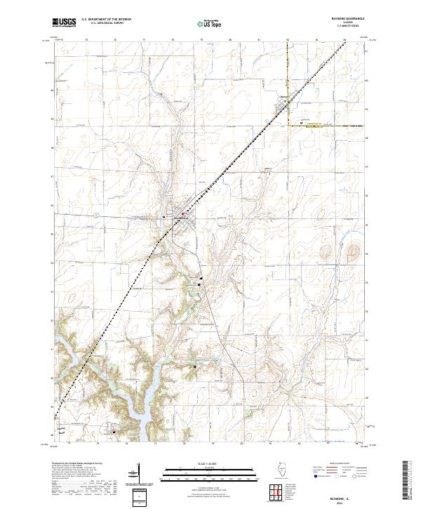
2024 Map of Raymond
USGS Topo · Published 2024About this map
Raymond and Harvel serve as the primary anchors of this central Illinois landscape, where the flat agricultural terrain is dissected by the meandering courses of West Fork Shoal Creek and Blue Grass Creek. The map reveals a high density of small family and community burial grounds, including the Asbury Cem and Saint Raymond Cem south of the main town, as well as the Cass Cem located further into the rural sections. The southern edge of the quadrangle is defined by the northern reaches of Lake Lou Yaeger, while the small settlement of Honey Bend sits near the Montgomery County line. The grid of rural routes, such as Co RD 2500 N and Oilfield Ave, highlights the modern transportation network laid over an older patterns of creek-side settlements and early cemeteries.
Find a feature on this map
52 named features on this map. Tap any name to fly to it.
Don’t see what you’re looking for? This feature index may not catch every label — zoom into the map to look around manually.
Map Details
Editions of this 2024 Raymond Map
This is the sole edition of this map. No revisions or reprints were ever made.
Other maps of this area

1915 · Mount Olive
USGS Topo · 1:62,500

1923 · Raymond
USGS Topo · 1:62,500

1925 · Raymond
USGS Topo · 1:62,500

1944 · Mount Olive
USGS Topo · 1:62,500

1946 · Nokomis
USGS Topo · 1:62,500

1947 · Hillsboro
USGS Topo · 1:62,500

1949 · Hillsboro
USGS Topo · 1:62,500

1949 · Nokomis
USGS Topo · 1:62,500

1958 · Decatur
USGS Topo · 1:250,000

1961 · Decatur
USGS Topo · 1:250,000