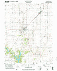
1998 Map of Raymond
USGS Topo · Published 2002About this map
Raymond and Harvel serve as the primary population centers in this agricultural landscape near the Montgomery and Christian County border. The terrain is defined by the drainage of West Fork Shoal Creek and Blue Grass Creek, which cut through the level prairie lands. To the south, the northern reaches of Lou Yaeger Lake create a distinct shoreline environment, complete with a Campground and surrounding woods that contrast with the gridded fields above.
Find a feature on this map
32 named features on this map. Tap any name to fly to it.
Don’t see what you’re looking for? This feature index may not catch every label — zoom into the map to look around manually.
Map Details
Editions of this 1998 Raymond Map
This is the sole edition of this map. No revisions or reprints were ever made.
Other maps of this area

1915 · Mount Olive
USGS Topo · 1:62,500

1923 · Raymond
USGS Topo · 1:62,500

1925 · Raymond
USGS Topo · 1:62,500

1944 · Mount Olive
USGS Topo · 1:62,500

1946 · Nokomis
USGS Topo · 1:62,500

1947 · Hillsboro
USGS Topo · 1:62,500

1949 · Hillsboro
USGS Topo · 1:62,500

1949 · Nokomis
USGS Topo · 1:62,500

1958 · Decatur
USGS Topo · 1:250,000

1961 · Decatur
USGS Topo · 1:250,000