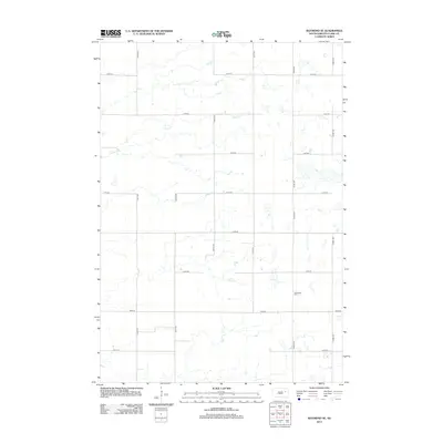
2012 Map of Raymond SE
USGS Topo · Published 2012About this map
Darlington Cem stands as a primary historical point of interest in this section of Clark County, situated along the north-south corridor of 422nd Ave. The landscape is defined by the subtle drainage of Foster Cr, which meanders across the northern half of the territory. The map reveals a strictly organized section-line road grid, where east-west routes like 174th St and 180th St intersect with numbered avenues, reflecting the enduring legacy of the Public Land Survey System in South Dakota's agricultural heartland. This 2012 documentation by the U.S. Geological Survey preserves the late-twentieth-century rural infrastructure, focusing on the essential landmarks of a sparsely populated prairie environment.
Find a feature on this map
16 named features on this map. Tap any name to fly to it.
Don’t see what you’re looking for? This feature index may not catch every label — zoom into the map to look around manually.
Map Details
Editions of this 2012 Raymond SE Map
This is the sole edition of this map. No revisions or reprints were ever made.
Other maps of this area

1953 · Watertown
USGS Topo · 1:250,000

1958 · Watertown
USGS Topo · 1:250,000
1973 · Baileys Lake
USGS Topo · 1:24,000
1973 · Raymond
USGS Topo · 1:24,000

1973 · Willow Lake
USGS Topo · 1:24,000

1973 · Clark South
USGS Topo · 1:24,000
1973 · Clark North
USGS Topo · 1:24,000
1973 · Carpenter
USGS Topo · 1:24,000
1973 · Raymond SE
USGS Topo · 1:24,000
1973 · Carpenter NE
USGS Topo · 1:24,000