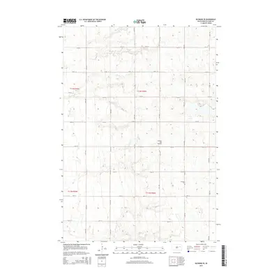
2015 Map of Raymond SE
USGS Topo · Published 2015About this map
Coteau des Prairies, a vast upland plateau, dominates this portion of Clark County. The landscape is defined by its subtle glacial topography and the presence of Foster Cr, which meanders through the northern sections. In the southeast, the Darlington Cem serves as a quiet marker of the local community's heritage. The area is structured by a precise grid of rural roads, including 174th St and 420th Ave, reflecting the enduring agricultural organization of the South Dakota plains. This survey captures the region during a period of modern land management, where the intersection of natural drainage and established property lines continues to shape the character of the prairie.
Find a feature on this map
21 named features on this map. Tap any name to fly to it.
Don’t see what you’re looking for? This feature index may not catch every label — zoom into the map to look around manually.
Map Details
Editions of this 2015 Raymond SE Map
This is the sole edition of this map. No revisions or reprints were ever made.
Other maps of this area

1953 · Watertown
USGS Topo · 1:250,000

1958 · Watertown
USGS Topo · 1:250,000
1973 · Baileys Lake
USGS Topo · 1:24,000
1973 · Raymond
USGS Topo · 1:24,000

1973 · Willow Lake
USGS Topo · 1:24,000

1973 · Clark South
USGS Topo · 1:24,000
1973 · Clark North
USGS Topo · 1:24,000
1973 · Carpenter
USGS Topo · 1:24,000
1973 · Raymond SE
USGS Topo · 1:24,000
1973 · Carpenter NE
USGS Topo · 1:24,000