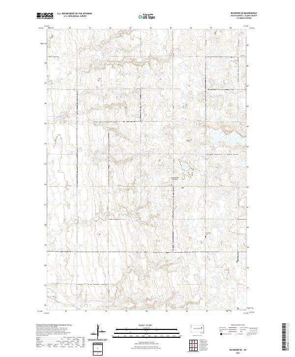
2021 Map of Raymond SE
USGS Topo · Published 2021About this map
The Coteau des Prairies plateau defines the undulating landscape of this Clark County region, where the high ground is punctuated by numerous small depressions and seasonal wetlands. The agricultural grid is well-established, with roads like Co Rd 33 and 177th St providing access to the sectioned prairie lands. One of the few non-agricultural landmarks is the Darlington Cem in the southeastern portion of the quadrangle, serving as a quiet focal point for local genealogical interest. The intermittent flow of Foster Cr meanders through the northern townships, cutting through the glacial till of the upland plain. This survey reflects the steady, enduring character of South Dakota's rural heartland, documenting the exact placement of sections, township boundaries, and the local road network as they existed in the early twenty-first century.
Find a feature on this map
16 named features on this map. Tap any name to fly to it.
Don’t see what you’re looking for? This feature index may not catch every label — zoom into the map to look around manually.
Map Details
Editions of this 2021 Raymond SE Map
This is the sole edition of this map. No revisions or reprints were ever made.
Other maps of this area

1953 · Watertown
USGS Topo · 1:250,000

1958 · Watertown
USGS Topo · 1:250,000
1973 · Baileys Lake
USGS Topo · 1:24,000
1973 · Raymond
USGS Topo · 1:24,000

1973 · Willow Lake
USGS Topo · 1:24,000

1973 · Clark South
USGS Topo · 1:24,000
1973 · Clark North
USGS Topo · 1:24,000
1973 · Carpenter
USGS Topo · 1:24,000
1973 · Raymond SE
USGS Topo · 1:24,000
1973 · Carpenter NE
USGS Topo · 1:24,000