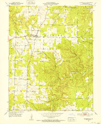
1951 Map of Raymondville
USGS Topo · Published 1952About this map
Raymondville serves as the primary hub in this mid-century survey of Texas County, where the Ozark landscape is defined by an intricate network of hollows and ridges. The settlement pattern is largely rural, with established social centers like Friendship Sch and High Point Sch serving the surrounding agricultural families. In the southern portion of the quadrangle, Yukon appears near the Yukon Sch, illustrating the dispersed community structure of the era.
Find a feature on this map
22 named features on this map. Tap any name to fly to it.
Don’t see what you’re looking for? This feature index may not catch every label — zoom into the map to look around manually.
Map Details
Editions of this 1951 Raymondville Map
3 editions found
Other maps of this area

1932 · Cedar Grove
USGS Topo · 1:48,000

1945 · Clear Springs
USGS Topo · 1:62,500

1946 · Summersville
USGS Topo · 1:62,500

1948 · Clear Springs
USGS Topo · 1:62,500

1948 · Summersville
USGS Topo · 1:62,500

1949 · Rolla
USGS Topo · 1:250,000

1951 · Montauk
USGS Topo · 1:24,000

1951 · Licking
USGS Topo · 1:24,000

1951 · Raymondville
USGS Topo · 1:24,000

1951 · Prescott
USGS Topo · 1:24,000