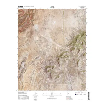
2017 Map of Rayo Hills
USGS Topo · Published 2017About this map
Rayo Hills and the dramatic geological passage of Chupadera Gap dominate this high-desert landscape along the border of Socorro and Torrance counties. The terrain is defined by a series of north-south ridges and deep drainages, including Montosa Canyon, Pelon Canyon, and Cañada de el Medio.
Find a feature on this map
29 named features on this map. Tap any name to fly to it.
Don’t see what you’re looking for? This feature index may not catch every label — zoom into the map to look around manually.
Map Details
Editions of this 2017 Rayo Hills Map
This is the sole edition of this map. No revisions or reprints were ever made.
Other maps of this area

1916 · La Joya
USGS Topo · 1:125,000

1952 · Becker
USGS Topo · 1:24,000

1952 · Cerro Montoso
USGS Topo · 1:24,000

1954 · Socorro
USGS Topo · 1:250,000

1958 · Socorro
USGS Topo · 1:250,000

1962 · Socorro
USGS Topo · 1:250,000
1972 · Sierra Larga North
USGS Topo · 1:24,000
1972 · Chupadera Spring
USGS Topo · 1:24,000

1972 · Chupadera
USGS Topo · 1:24,000

1972 · Abo
USGS Topo · 1:24,000