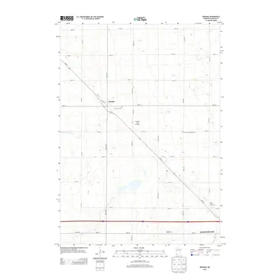
2013 Map of Reading
USGS Topo · Published 2013About this map
The Reading settlement and the northern outskirts of Worthington anchor this Nobles County landscape on the high ground of the Coteau des Prairies. This upland plateau, a significant terminal moraine, dictates the drainage of the region as water flows into local tributaries like Elk Creek and Okabena Creek. The area's agricultural heritage is reflected in a systematic grid of section roads and the presence of historic burial sites such as Summit Lake Cemetery and the Church of the Brethren Cemetery. Modern transportation and recreation are represented by the corridor of Interstate 90 and the Prairie View Golf Links. The map reveals a transition from the structured street plan of Worthington near the Garden of Memories to the more open, rural farmsteads of the surrounding prairie.
Find a feature on this map
29 named features on this map. Tap any name to fly to it.
Don’t see what you’re looking for? This feature index may not catch every label — zoom into the map to look around manually.
Map Details
Editions of this 2013 Reading Map
This is the sole edition of this map. No revisions or reprints were ever made.
Other maps of this area

1954 · Fairmont
USGS Topo · 1:250,000

1958 · Fairmont
USGS Topo · 1:250,000

1960 · Reading
USGS Topo · 1:24,000

1960 · Bigelow
USGS Topo · 1:24,000

1960 · Worthington North
USGS Topo · 1:24,000

1960 · Worthington South
USGS Topo · 1:24,000

1967 · Rushmore
USGS Topo · 1:24,000

1967 · Wilmont
USGS Topo · 1:24,000

1967 · Adrian NE
USGS Topo · 1:24,000

1970 · Fulda
USGS Topo · 1:24,000