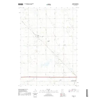
2019 Map of Reading
USGS Topo · Published 2019About this map
Reading sits along the northwest-southeast diagonal of State Hwy 266, serving as a focal point in a landscape defined by the Coteau des Prairies upland. This plateau region in Nobles County is characterized by a high concentration of wetlands and small basins, particularly evident near the headwaters of Elk Cr and Okabena Cr. The agricultural grid is densely populated with local landmarks important to genealogists, including Summit Lake Cem near the town center and the Church of the Brethren Cem to the east. The southern edge of the survey transitions into the outskirts of Worthington, where the Garden of Memories is located. The water management of the era is represented by engineered features like County Ditch Number Five, which supports the surrounding farmland.
Find a feature on this map
25 named features on this map. Tap any name to fly to it.
Don’t see what you’re looking for? This feature index may not catch every label — zoom into the map to look around manually.
Map Details
Editions of this 2019 Reading Map
This is the sole edition of this map. No revisions or reprints were ever made.
Other maps of this area

1954 · Fairmont
USGS Topo · 1:250,000

1958 · Fairmont
USGS Topo · 1:250,000

1960 · Reading
USGS Topo · 1:24,000

1960 · Bigelow
USGS Topo · 1:24,000

1960 · Worthington North
USGS Topo · 1:24,000

1960 · Worthington South
USGS Topo · 1:24,000

1967 · Rushmore
USGS Topo · 1:24,000

1967 · Wilmont
USGS Topo · 1:24,000

1967 · Adrian NE
USGS Topo · 1:24,000

1970 · Fulda
USGS Topo · 1:24,000