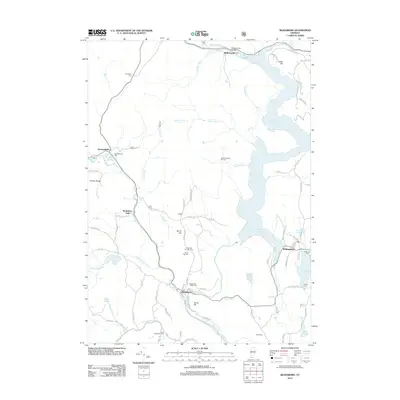
2012 Map of Readsboro
USGS Topo · Published 2012About this map
Readsboro sits at the confluence of the Deerfield River and several mountain brooks, serving as a focal point for the surrounding highlands of the Hoosac Range and North Hill. The landscape is defined by the massive Harriman Reservoir, which fills the valley floor north of Whitingham. This modern survey reveals a dense network of local routes like Potter Hill Rd and Stimpson Hill Rd that connect isolated valley settlements with higher elevations such as Jarvis Hill and Castle Hill.
Find a feature on this map
89 named features on this map. Tap any name to fly to it.
Don’t see what you’re looking for? This feature index may not catch every label — zoom into the map to look around manually.
Map Details
Editions of this 2012 Readsboro Map
This is the sole edition of this map. No revisions or reprints were ever made.
Other maps of this area

1886 · Greylock
USGS Topo · 1:62,500

1886 · Hawley
USGS Topo · 1:62,500

1889 · Wilmington
USGS Topo · 1:62,500

1890 · Hawley
USGS Topo · 1:62,500

1891 · Wilmington
USGS Topo · 1:62,500

1891 · Greylock
USGS Topo · 1:62,500

1893 · Greylock
USGS Topo · 1:62,500

1894 · Hawley
USGS Topo · 1:62,500

1898 · Bennington
USGS Topo · 1:62,500

1898 · Greylock
USGS Topo · 1:62,500