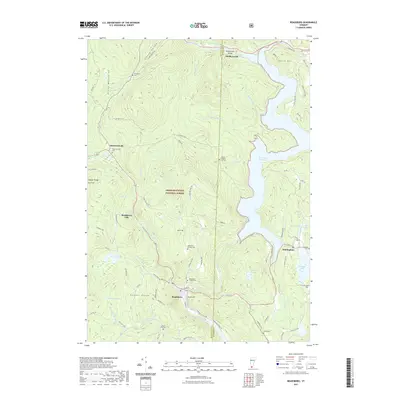
2021 Map of Readsboro
USGS Topo · Published 2021About this map
The Deerfield River and its various tributaries carve through the southern reaches of the Green Mountains on this 2021 study of southern Vermont. This landscape is defined by the significant footprint of the Green Mountain National Forest and the large expanse of the Harriman Reservoir, which dominates the eastern half of the terrain. The settlement pattern shows small clusters of development at Readsboro and Whitingham, connected by winding roads that follow the natural topography of the Hoosac Range and North Hill.
Find a feature on this map
85 named features on this map. Tap any name to fly to it.
Don’t see what you’re looking for? This feature index may not catch every label — zoom into the map to look around manually.
Map Details
Editions of this 2021 Readsboro Map
This is the sole edition of this map. No revisions or reprints were ever made.
Other maps of this area

1886 · Greylock
USGS Topo · 1:62,500

1886 · Hawley
USGS Topo · 1:62,500

1889 · Wilmington
USGS Topo · 1:62,500

1890 · Hawley
USGS Topo · 1:62,500

1891 · Wilmington
USGS Topo · 1:62,500

1891 · Greylock
USGS Topo · 1:62,500

1893 · Greylock
USGS Topo · 1:62,500

1894 · Hawley
USGS Topo · 1:62,500

1898 · Bennington
USGS Topo · 1:62,500

1898 · Greylock
USGS Topo · 1:62,500