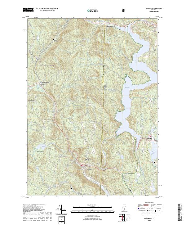
2024 Map of Readsboro
USGS Topo · Published 2024About this map
The Deerfield River and its various branches carve through the southern Green Mountain National Forest, anchoring a landscape defined by steep elevation changes and historic mountain settlements. Near the center of the sheet, Readsboro sits at the confluence where the river meets West Branch Deerfield River. The eastern side of the quadrangle is dominated by the expansive Harriman Reservoir, which significantly reshaped the local topography compared to earlier eras. Genealogists will find several family-named burial grounds throughout the hills, including the Jewell-Wheeler Hill Cem and North Hill-Amidon Cem. The transition from the Hoosac Range to the river valleys is marked by older infrastructure such as the Hoot Toot and Whistle Trl, a path following the historic rail corridor that once supported the local timber and industrial economy.
Find a feature on this map
87 named features on this map. Tap any name to fly to it.
Don’t see what you’re looking for? This feature index may not catch every label — zoom into the map to look around manually.
Map Details
Editions of this 2024 Readsboro Map
This is the sole edition of this map. No revisions or reprints were ever made.
Other maps of this area

1886 · Greylock
USGS Topo · 1:62,500

1886 · Hawley
USGS Topo · 1:62,500

1889 · Wilmington
USGS Topo · 1:62,500

1890 · Hawley
USGS Topo · 1:62,500

1891 · Wilmington
USGS Topo · 1:62,500

1891 · Greylock
USGS Topo · 1:62,500

1893 · Greylock
USGS Topo · 1:62,500

1894 · Hawley
USGS Topo · 1:62,500

1898 · Bennington
USGS Topo · 1:62,500

1898 · Greylock
USGS Topo · 1:62,500