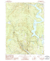
1987 Map of Readsboro
USGS Topo · Published 1987About this map
The Green Mountains dominate this 1980s landscape, where the Deerfield River and its numerous tributaries have been harnessed for hydroelectric power. The massive Harriman Reservoir defines the eastern half of the area, creating an intricate shoreline that skirts Wilmington and Whitingham. To the south, the Sherman Reservoir marks the river's path as it flows toward the Massachusetts border.
Find a feature on this map
45 named features on this map. Tap any name to fly to it.
Don’t see what you’re looking for? This feature index may not catch every label — zoom into the map to look around manually.
Map Details
Editions of this 1987 Readsboro Map
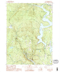
2 editions found
Other maps of this area

1886 · Greylock
USGS Topo · 1:62,500

1886 · Hawley
USGS Topo · 1:62,500

1889 · Wilmington
USGS Topo · 1:62,500

1890 · Hawley
USGS Topo · 1:62,500

1891 · Wilmington
USGS Topo · 1:62,500

1891 · Greylock
USGS Topo · 1:62,500

1893 · Greylock
USGS Topo · 1:62,500

1894 · Hawley
USGS Topo · 1:62,500

1898 · Bennington
USGS Topo · 1:62,500

1898 · Greylock
USGS Topo · 1:62,500