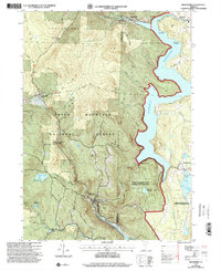
1997 Map of Readsboro
USGS Topo · Published 2000About this map
Harriman Reservoir dominates the eastern portion of this Vermont landscape, where the Deerfield River and its numerous tributaries such as Wilder Brook and Boyd Brook drain the wooded uplands of the Green Mountain National Forest. The map captures the late-century settlement patterns of Readsboro, Whitingham, and Wilmington, linked by winding roads and the traces of the Old Stage Road. These communities are defined by their proximity to the water, with the industrial legacy of the river evidenced by the Concrete Spillway and Stone Dam.
Find a feature on this map
47 named features on this map. Tap any name to fly to it.
Don’t see what you’re looking for? This feature index may not catch every label — zoom into the map to look around manually.
Map Details
Editions of this 1997 Readsboro Map
This is the sole edition of this map. No revisions or reprints were ever made.
Other maps of this area

1886 · Greylock
USGS Topo · 1:62,500

1886 · Hawley
USGS Topo · 1:62,500

1889 · Wilmington
USGS Topo · 1:62,500

1890 · Hawley
USGS Topo · 1:62,500

1891 · Wilmington
USGS Topo · 1:62,500

1891 · Greylock
USGS Topo · 1:62,500

1893 · Greylock
USGS Topo · 1:62,500

1894 · Hawley
USGS Topo · 1:62,500

1898 · Bennington
USGS Topo · 1:62,500

1898 · Greylock
USGS Topo · 1:62,500