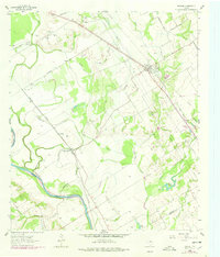
1962 Map of Reagan
USGS Topo · Published 1978About this map
The Brazos River meanders across the southwestern corner of this Falls County landscape, shaping a fertile bottomland defined by Highbank Creek and Wild Horse Slough. Near the river, the settlement of Highbank sits along the Missouri Pacific rail line, which cuts a straight path toward the community of Coymack. The terrain is deeply marked by local family history and rural congregation sites, including Washington Cem, Summers Cem, and New Bowman Cem north of Big Creek.
Find a feature on this map
45 named features on this map. Tap any name to fly to it.
Don’t see what you’re looking for? This feature index may not catch every label — zoom into the map to look around manually.
Map Details
Editions of this 1962 Reagan Map
2 editions found
Other maps of this area

1954 · Waco
USGS Topo · 1:250,000

1955 · Waco
USGS Topo · 1:250,000

1957 · McClanahan
USGS Topo · 1:24,000

1957 · Marlin
USGS Topo · 1:24,000

1961 · Baileyville
USGS Topo · 1:24,000

1962 · Rosebud
USGS Topo · 1:24,000

1962 · Hammond
USGS Topo · 1:24,000

1962 · Reagan
USGS Topo · 1:24,000

1962 · Cedar Springs
USGS Topo · 1:24,000

1962 · Bremond
USGS Topo · 1:24,000