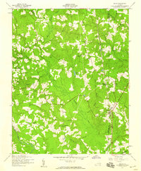
1952 Map of Reams
USGS Topo · Published 1959About this map
Rowanty Creek and its many tributaries, including Hatcher Run, Gravelly Run, and Arthur Swamp, define the low-lying landscape of this Virginia countryside in the early 1950s. The Atlantic Coast Line railroad serves as the primary industrial artery, passing through the settlements of Reams and Carson, the latter of which features a concentrated development of homes, a High School, and an Athletic Field. Local rural life is evidenced by the distribution of numerous country churches and small schoolhouses such as Rowanta Church and Watts School. A notable landmark, the Confederate Camp, stands as a reminder of the region's mid-19th-century military movements near the Dinwiddie and Prince George county line. The map captures a transition period for these communities before the expansion of modern highways, showing a dense network of secondary roads connecting scattered farmsteads and swampy woodlands like Brick Kill Swamp.
Find a feature on this map
36 named features on this map. Tap any name to fly to it.
Don’t see what you’re looking for? This feature index may not catch every label — zoom into the map to look around manually.
Map Details
Editions of this 1952 Reams Map
This is the sole edition of this map. No revisions or reprints were ever made.
Other maps of this area

1894 · Petersburg
USGS Topo · 1:62,500

1897 · Amelia
USGS Topo · 1:125,000

1919 · Jarratt
USGS Topo · 1:62,500

1919 · Mc Kenney
USGS Topo · 1:48,000

1921 · Mc Kenney
USGS Topo · 1:62,500

1943 · Mc Kenney
USGS Topo · 1:62,500

1943 · Dinwiddie
USGS Topo · 1:24,000

1943 · Sutherland
USGS Topo · 1:24,000

1943 · Richmond
USGS Topo · 1:250,000

1944 · Reams
USGS Topo · 1:31,680