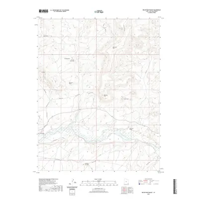
2020 Map of Recapture Pocket
USGS Topo · Published 2020About this map
San Juan River flows through a landscape defined by dramatic sandstone formations and high plateaus in the Shiprock Agency region. The southern edge of the quadrangle is anchored by Casa del Eco Mesa, while the northern portion is marked by the expansive McCracken Mesa and the distinctively named The Horn. The drainage patterns are dominated by Recapture Creek, which winds through the Recapture Pocket before joining the main river valley near San Juan Valley.
Find a feature on this map
34 named features on this map. Tap any name to fly to it.
Don’t see what you’re looking for? This feature index may not catch every label — zoom into the map to look around manually.
Map Details
Editions of this 2020 Recapture Pocket Map
This is the sole edition of this map. No revisions or reprints were ever made.
Other maps of this area

1886 · Abajo
USGS Topo · 1:250,000

1892 · Abajo
USGS Topo · 1:250,000

1893 · Abajo
USGS Topo · 1:250,000

1956 · Cortez
USGS Topo · 1:250,000

1958 · Cortez
USGS Topo · 1:250,000

1959 · Cortez
USGS Topo · 1:250,000

1962 · Cortez
USGS Topo · 1:250,000

1962 · Montezuma Creek
USGS Topo · 1:62,500

1962 · Bluff
USGS Topo · 1:62,500
1962 · Boundary Butte
USGS Topo · 1:62,500