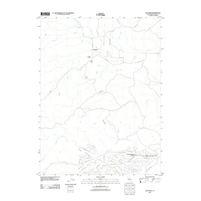
2012 Map of Red Bank
USGS Topo · Published 2012About this map
Rancho Tehama Reserve occupies the southern reaches of this landscape, characterized by a complex grid of residential roads named after California counties and western themes like Rainbow Rdg and Stagecoach Rd. This planned community development contrasts sharply with the open drainage basins of the north, where the settlement of Red Bank sits near the confluence of Red Bank Cr and its northern forks. The terrain is deeply defined by a series of parallel creeks flowing eastward, including Elder Cr, Oat Cr, and Clover Cr.
Find a feature on this map
54 named features on this map. Tap any name to fly to it.
Don’t see what you’re looking for? This feature index may not catch every label — zoom into the map to look around manually.
Map Details
Editions of this 2012 Red Bank Map
This is the sole edition of this map. No revisions or reprints were ever made.
Other maps of this area

1890 · Red Bluff
USGS Topo · 1:250,000

1894 · Red Bluff
USGS Topo · 1:250,000

1944 · Flournoy
USGS Topo · 1:62,500

1949 · Colyear Springs
USGS Topo · 1:62,500

1951 · West of Gerber
USGS Topo · 1:24,000

1951 · Red Bluff West
USGS Topo · 1:24,000

1952 · Blossom
USGS Topo · 1:24,000

1952 · Red Bank
USGS Topo · 1:24,000

1952 · Paskenta
USGS Topo · 1:62,500

1952 · Red Bank
USGS Topo · 1:62,500