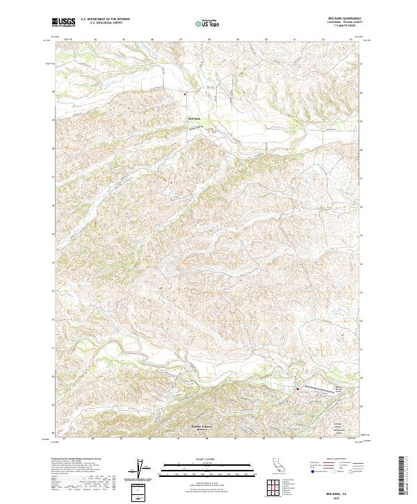
2022 Map of Red Bank
USGS Topo · Published 2022About this map
Rancho Tehama Reserve occupies the southern portion of this landscape, where a dense network of residential roads like Stagecoach Rd and Lariat Loop meets the meandering course of Elder Cr. Further north, the settlement of Red Bank sits near the crossing of Red Bank Rd and Red Bank Cr, illustrating the historical importance of water access in this part of the Sacramento Valley. The terrain is defined by distinct topographical depressions such as Hungry Hollow, Vale Gulch, and Government Gulch, which channel seasonal runoff into the larger creek systems. These features, along with the Rancho Tehama Airport, reflect a mix of rural aviation, planned community development, and traditional ranching geography in Tehama County.
Find a feature on this map
61 named features on this map. Tap any name to fly to it.
Don’t see what you’re looking for? This feature index may not catch every label — zoom into the map to look around manually.
Map Details
Editions of this 2022 Red Bank Map
This is the sole edition of this map. No revisions or reprints were ever made.
Other maps of this area

1890 · Red Bluff
USGS Topo · 1:250,000

1894 · Red Bluff
USGS Topo · 1:250,000

1944 · Flournoy
USGS Topo · 1:62,500

1949 · Colyear Springs
USGS Topo · 1:62,500

1951 · West of Gerber
USGS Topo · 1:24,000

1951 · Red Bluff West
USGS Topo · 1:24,000

1952 · Blossom
USGS Topo · 1:24,000

1952 · Red Bank
USGS Topo · 1:24,000

1952 · Paskenta
USGS Topo · 1:62,500

1952 · Red Bank
USGS Topo · 1:62,500