
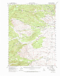
1952 Map of Red Bank
USGS Topo · Published 1959About this map
Red Bluff serves as the eastern anchor for this mid-century survey, where the Southern Pacific tracks and the Red Bluff Airport facilitate transit along the valley floor. West of the town, the landscape transitions into a network of seasonal drainages and cattle country, defined by features like La Barranca Colorada and the winding course of Red Bank Creek. Small rural communities and stops such as Blossom and Red Bank are connected by a grid of named local routes, including Reeds Creek Road and Paskenta Road. Educational life is documented through scattered landmarks like Marion Sch and Oat Creek Sch, while the Montgomery Lookout stands watch over the higher elevations to the west. This map preserves the mid-century layout of Tehama County before modern infrastructure reshaped the rural sections.
Find a feature on this map
60 named features on this map. Tap any name to fly to it.
Don’t see what you’re looking for? This feature index may not catch every label — zoom into the map to look around manually.
Map Details
Editions of this 1952 Red Bank Map
2 editions found
Other maps of this area

1890 · Red Bluff
USGS Topo · 1:250,000

1894 · Red Bluff
USGS Topo · 1:250,000

1904 · Vina
USGS Topo · 1:62,500

1905 · Tehama
USGS Topo · 1:62,500

1944 · Flournoy
USGS Topo · 1:62,500

1944 · Tuscan Buttes
USGS Topo · 1:62,500

1947 · Tuscan Buttes
USGS Topo · 1:62,500

1947 · Anderson
USGS Topo · 1:62,500

1948 · Anderson
USGS Topo · 1:62,500

1949 · Colyear Springs
USGS Topo · 1:62,500