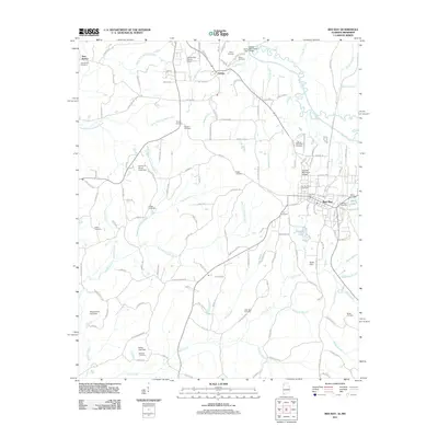
2011 Map of Red Bay
USGS Topo · Published 2011About this map
Red Bay serves as the primary hub in this borderland survey, situated where the terrain transitions across the Alabama-Mississippi line. The town's infrastructure is well-defined by the Red Bay Post Office and Red Bay Municipal Airport, while the surrounding landscape is marked by a high concentration of family and community burial grounds, such as Hillcrest Memorial Gardens and Red Bay Cemetery. To the northwest, the smaller settlements of Golden and New Bethel anchor rural crossroads near Tishomingo County Airport.
Find a feature on this map
146 named features on this map. Tap any name to fly to it.
Don’t see what you’re looking for? This feature index may not catch every label — zoom into the map to look around manually.
Map Details
Editions of this 2011 Red Bay Map
This is the sole edition of this map. No revisions or reprints were ever made.
Other maps of this area

1935 · Pleasant Site
USGS Topo · 1:24,000

1936 · Belmont
USGS Topo · 1:24,000

1936 · Red Bay
USGS Topo · 1:24,000

1936 · Vina
USGS Topo · 1:24,000

1936 · Halltown
USGS Topo · 1:24,000

1950 · Belmont
USGS Topo · 1:24,000

1950 · Vina
USGS Topo · 1:24,000
1950 · Halltown
USGS Topo · 1:24,000
1950 · Pleasant Site
USGS Topo · 1:24,000
1951 · Pleasant Site
USGS Topo · 1:24,000