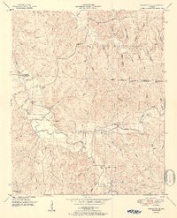
1951 Map of Pleasant Site
USGS Topo · Published 1951About this map
The Alabama Wildlife Refuge dominates the northeastern landscape of this mid-century survey, a region defined by the winding drainages of the Freedom Hills. The small settlement of Pleasant Site serves as a central point, surrounded by numerous small water bodies including Cedar Creek, Bear Creek, and Little Bear Creek. The area's agricultural and social history is visible through a network of rural landmarks such as Freedom Hills Church and several family burial grounds, including James Cem, Bolton Cem, and the Lower Pleasant Site Cem. This topography reveals a landscape of ridges and hollows, where Todd Ridge and Indian Hill overlook dozens of named branches like Wolf Pen Br and Sugar Camp Br. The inclusion of the Pope Lookout Tower and scattered Ruins provides a distinct view of the land use and forest management in this part of Franklin and Colbert counties during the post-war era.
Find a feature on this map
75 named features on this map. Tap any name to fly to it.
Don’t see what you’re looking for? This feature index may not catch every label — zoom into the map to look around manually.
Map Details
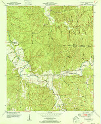
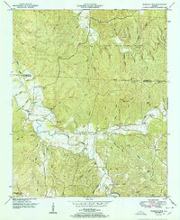
Editions of this 1951 Pleasant Site Map
3 editions found
Other maps of this area

1925 · Barton
USGS Topo · 1:62,500

1926 · Barton
USGS Topo · 1:48,000

1929 · Barton
USGS Topo · 1:62,500

1935 · Pleasant Site
USGS Topo · 1:24,000

1936 · Belmont
USGS Topo · 1:24,000

1936 · Pleasant Grove
USGS Topo · 1:24,000

1936 · Red Bay
USGS Topo · 1:24,000
1936 · Barton
USGS Topo · 1:24,000

1936 · Halltown
USGS Topo · 1:24,000

1936 · Bishop
USGS Topo · 1:24,000