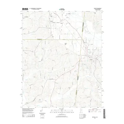
2014 Map of Red Bay
USGS Topo · Published 2014About this map
Red Bay sits at the intersection of Alabama and Mississippi, serving as a primary hub where the terrain transitions toward the Tennessee Valley Divide. This 2014 survey documents the dense network of rural roads and family cemeteries that define the borderlands of Franklin, Tishomingo, and Itawamba counties. The landscape is heavily dissected by waterways like Bear Creek and Chubby Cr, which drain the timbered ridges of the Freedom Hills.
Find a feature on this map
133 named features on this map. Tap any name to fly to it.
Don’t see what you’re looking for? This feature index may not catch every label — zoom into the map to look around manually.
Map Details
Editions of this 2014 Red Bay Map
This is the sole edition of this map. No revisions or reprints were ever made.
Other maps of this area

1935 · Pleasant Site
USGS Topo · 1:24,000

1936 · Belmont
USGS Topo · 1:24,000

1936 · Red Bay
USGS Topo · 1:24,000

1936 · Vina
USGS Topo · 1:24,000

1936 · Halltown
USGS Topo · 1:24,000

1950 · Belmont
USGS Topo · 1:24,000

1950 · Vina
USGS Topo · 1:24,000
1950 · Halltown
USGS Topo · 1:24,000
1950 · Pleasant Site
USGS Topo · 1:24,000
1951 · Pleasant Site
USGS Topo · 1:24,000